Auto-Pilot without Cruise Control 7 April 2009
Driving in Los Angeles is like walking in New York. It is utterly unavoidable and constantly shifting between extremes of exhilaration and annoyance. Automotive congestion, like pedestrian congestion, has its own internal rhythms, ebbs and flows, and these can change subtly and suddenly, requiring a Zen-like mastery of each new traffic situation whether on the sidewalks of 42nd Street or the egress lanes of the Hollywood Freeway. Mobility, regardless of its native form, must derive its essential character from urbanism as a way of life.
This might explain why driving in Los Angeles is so different from driving in New York. Cars are not indigenous to the five boroughs, despite Robert Moses’ attempts to prove otherwise. That’s not the case in L.A. As Reyner Banham observed nearly forty years ago, “like earlier generations of English intellectuals who learned Italian in order to read Dante in the original, I learned to drive to read Los Angeles in the original.”
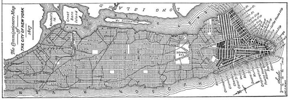
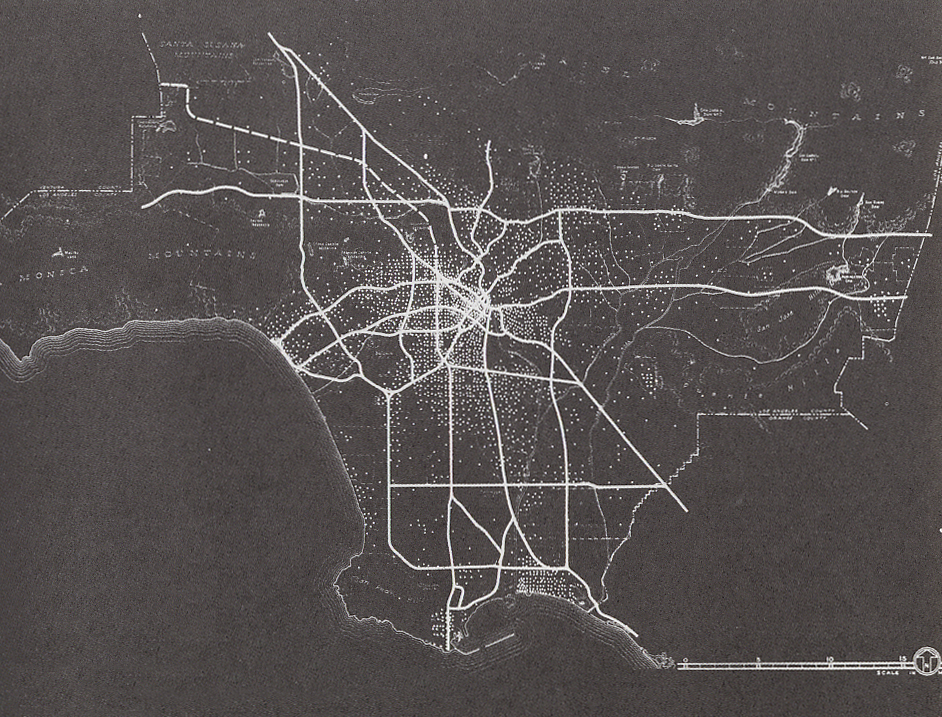
Compare the ur-circulation documents for each city and the distinction is clear.
The Commissioner’s Plan for New York (1807-11) laid out a horse and buggy street grid on the 23 square miles of Manhattan island. The Freeway Plan for Los Angeles (1940-43) laid out an automotive highway network on the 4,000 square miles of Los Angeles County.
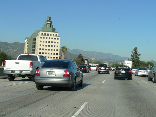
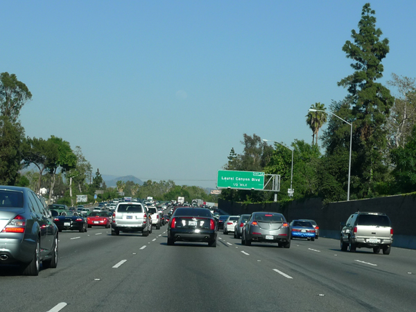
The difference is even more obvious when you are behind the wheel in L.A. and the freeway opens wides on the other side of your windshield: as many as six lanes in either direction, dedicated streams of entrance and egress, and spacious junctions and interchanges whose straightforward utility masks their enormous complexity.
Though my evidence is admittedly anecdotal (after only a week on L.A.’s roads), it seems as if the local driving style follows the lead of freeway design. If driving in New York is about jockeying for position, driving in L.A. is about forward momentum. If driving in New York is spasmodic and competitive, driving in L.A. is smooth and confident. Maybe it’s cruise control that produces the steadiness of the driving here; or maybe the steadiness of the driving allows the use of cruise control. I can’t test either hypothesis because my car doesn’t have the right equipment.
Still, as I’ve been motoring across the county, from surface road to freeway, from the 5 to the 10 to the 405 to the 101 to the 134 (note the use of the definite article, a local custom), there have been moments when the driving becomes strangely familiar. It was positively uncanny the other day, when I drove to Los Feliz on the 110.
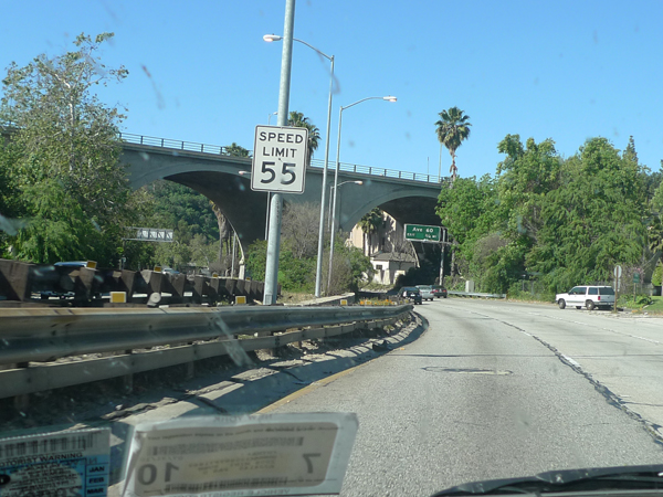
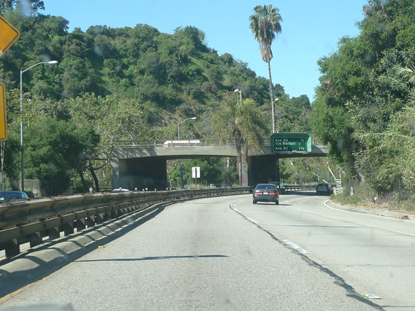
The right-of-way and the roadbed shrank. The curves got tighter and the lanes got narrower. Even the overpasses were shorter, plunging each car into momentary darkness. Exits came up fast and disappeared just as quickly. Cars cut each other off to avoid entering traffic. All around me it felt like laid-back, one handed driving was giving way to intense focus with two hands gripping the wheel tightly.
______________________
I knew this was the Pasadena Freeway, but it felt more like the Bronx River Parkway. It felt, in other words, like an old road. Not old the way El Camino Real is an old road (the Camino runs along part of US-101 as it passes through the city and has a special highway designation), but old for a high-speed motorway, and certainly old for Los Angeles.
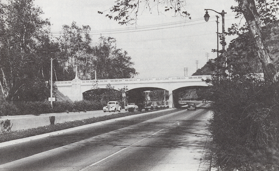
The earliest, northernmost sections of the Pasadena Freeway were built in the late 1930s as the Arroyo Seco Parkway. The first grade-separated, limited-access, divided-highway in the urban west (according to HAER), the Arroyo Seco laid the foundation for what would become L.A.’s iconic freeway system after WWII.
Like Connecticut’s Merritt Parkway, its exact contemporary, the Arroyo Seco was a hybrid: half scenic motorway intended for pleasure driving along the old gorge and half high-speed corridor intended for commuting between downtown and the northeastern communities. But by the time the full length of the road was completed in the 1950s, the original six mile stretch of the Arroyo Seco was subsumed into the county’s ever expanding freeway network.
Today, though vestiges of the parkway are evident in the lushness of the landscape and the detailing of the bridges, most drivers probably register the road’s uniqueness more intuitively or subconsciously as a kind of auto-body-driving-reflex. At any rate, I registered it that way. Forget the 12-lane freeway; here was a road I knew how to drive. I threw the Clubman into sixth and took the next curve without braking. And then I casually took one hand off the steering wheel.

Since I don’t drive I’m not in a good position to comment on the psychogeography of driving on either coast, but I do remember one piece of advice (a mantra really) from an Angeleno: when driving east to west “always take Fountain.”
J
Give my regards to Sunset! Go downtown for a french-dip sandwich @ Phillippe’s- it’s the best place in downtown LA. Mexican food @ The Talpa on Pico (closer to Santa Monica); hamburger & apple pie @ The Apple Pan (also on Pico in West LA); Pastries @ Benes Bakery on 3rd Street in W. Hollywood (if any of these places are still there). Take advantage of my 15 years in LA- these are the places to eat! Penny sends her love, as always. She keeps walking on the keyboard; I take no credit for the typos. We miss you!
My parents still use names for most of the freeways–so, the Ventura, the Golden State, the Harbor, the Santa Monica, the San Diego, the Pasadena, the Glendale, etc. I find that traffic reports and younger residents seem to use the numbers more often. Possible parallel with New Yorkers who call the subway lines the Seventh Avenue (or use old abbreviations, like the BMT or the double R)? Drive carefully!
While the driving observations are spot on, as a planner I just have to say that comparing the 1811 plan of manhattan to the 1940 plan of the entire LA region might not be a good comparison. See this turn of the century LA map
http://worldmapsonline.com/images/Los-Angeles-CA-1909.gif
and New York has a 1940s era plan centered on the LIE and the BQE which is how many people experience the region.
http://assets.nydailynews.com/img/2007/11/06/gal_aerial_1.jpg
Just the opinion of a former Angelino and present New Yorker